Table of Contents - Tools for Zoning Modernization
Leverage Advanced Technology to Access Better Intel
Customized zoning tools simplify historically complex research
Decades of first-hand experience exposed the experts at Kendig Keast Collaborative to the challenges of communicating, understanding and researching zoning regulations.
With the help of a team of tech wizards, they developed a set of zoning tools specifically designed to address these issues.
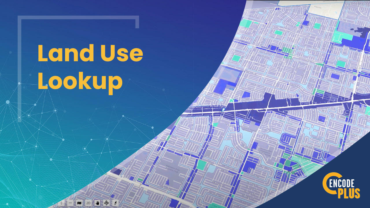
For example, our Land Use Lookup Tool identifies where specific land uses are permitted by-right, by review or by a special process and then displays all districts and addresses on an integrated GIS map.
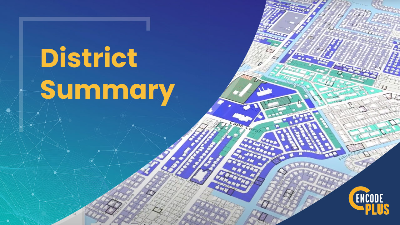
The District Summary is a quick-reference tool that shows applicable land uses, building setbacks and heights, and other dimensional standards for an address, parcel or zoning district.
While many of these zoning tools are dynamically integrated with GIS, others help streamline non-GIS-powered research.
SmartSearch shows everything the Land Use Lookup and District Summary tools display, but without the GIS map. Simply choose an address, parcel, district or use to display all applicable details in an exportable report. Print and go!
Zoning requirements are based on lot areas and widths, floor area, pervious and impervious areas, density and many other variables requiring calculation.
Our Development Calculators can be calibrated and customized to identify unique parameters and quantify the requirements for any project.
Implement powerful tools to modernize your zoning practices today.
Bypass the need to scour the district and use tables to find, assemble and make note of all applicable regulations and standards in order to determine what is possible for a specific land use or address.
It’s at your fingertips with a click.
District Summary
Search an address, parcel ID or zoning district, or simply click a property on an interactive GIS map to instantaneously identify the zoning of the property.
Understanding the allowed uses, dimensional standards, required parking, landscaping, signage, lighting, and the steps in the process to gain approval couldn’t be easier.
SMARTSEARCH
Through a public portal on your website, a user can view everything, but drill down to the exact zoning district, land use or property information they need. Search districts, land uses, addresses or parcels for a neatly formatted summary.
No more or less than what they need. Export or print with ease.
DEVELOPMENT CALCULATORS
Quickly determine quantities required to comply with regulations and standards with our custom-built development calculators. They will be calibrated to match your community’s regulatory requirements.
Help your applicants meet requirements the first time.
Explore our Development Calculators below!
Explore the Development Standards Calculators
Bufferyards
Specifies the buffer width, and the types and quantities of trees, shrubs and groundcover, allowing substitution of landforms or structures; upgrade to a visual simulator to test variations against performance measures.
Development Yield
Districts, development types and their lot areas and widths, housing types and heights, and rights-of-way widths determine allowable dwelling units, along with set-asides for open space, buffers, environmental resources, and storm drainage.
Fees
Accommodating various schedules, this calculator covers the fees for planning, development, engineering, construction, assurances, permits, inspections, and more.
Landscaping & Screening
Outputting types and numbers of trees and shrubs, this calculator spells out the planting requirements for pervious areas, parking lots, streetscapes, and screening devices.
Parkland Dedication
Determines land dedication or fee in-lieu requirements for parks, trails, greenways, and amenities based on the allocation of need, district, and development type.
Parking and Loading
Quantifying parking and loading spaces based on land use, occupancy, vehicle type, and proximity to special districts; this calculator specifies required spaces and allows for credits and reductions.
Signage
Factoring development type, location and district, this calculator determines the types, numbers, areas, heights and locations of attached, freestanding and temporary signs.
Floor Area Ratio
Factoring lot area, building heights and setbacks, pervious area, and parking, this calculator determines the maximum gross and net square footage of floor space by district, development type or form, and/or land use.
Custom Calculators
In addition to these standard calculators, we can build and calibrate custom calculators upon request. Inquire for more information. Check out these custom calculators we built for Somerville, MA.
Don't See the Calculator You Need?
WE CAN CUSTOM-BUILD ONE FOR YOU
We have tailored unique calculators for housing affordability, tree preservation and replacement, linkage and civic/open space payments, and even outdoor lighting. Just let us know what you need.
What do clients say?
I think our staff and the consultants we work with are going to appreciate the calculators. I know signs, buffers, and parking are already getting a lot of use.
— Summer Morris Hobson Principal Planner, Comprehensive Planning & Research Chesterfield County Planning Department