Integrate Zoning Tools to Streamline Property Research
Table of Contents - Parcel Summary

Everything You Need to Know About a Parcel or Address
Due diligence is easy with enCodePlus zoning research tools
How many hoops do you have to jump through to collect information about a specific land parcel or address? Is this something you do often?
Now, with just a click, you can glean important information for any parcel.
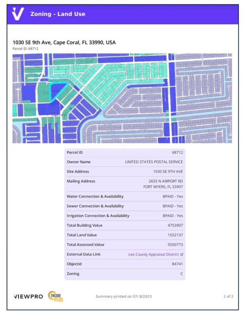
It’s so easy, simply enter an address or click a parcel on a map to see:
- Google Street View
- Parcel identification number
- Site mailing address(es)
- Ownership
- Year built
- Land, building and total assessed values
- Permits
- Zoning with links to ordinances and tools
- Other information like neighborhood, school district, council district, utility providers – any parcel data maintained by the jurisdiction
Just select your parcel to produce a summary report, then export, print or share.
While similar information might be found on the website for the local appraisal district or assessor’s office, the value of the Parcel Summary Tool is its pairing with the county or municipal zoning data to understand the regulations or restrictions that may apply.
Ready to Maximize Access to Parcel Data?
POWER UP MORE DETAILED PARCEL ANALYSIS
The attributes associated with parcels, such as parcel ID, address, ownership, values, and lot and building areas are essential to our daily work. While this data is available – sometimes in a separate, outdated database – it’s not as usable as we would like it to be.
Now, this parcel data is included among many useful data layers in the enCodePlus Zoning Tool Box, empowering you to quickly and easily view, analyze, and generate summary reports for print or export. It’s all included!
Why enCodePlus?
Info & Resources: Links, Blogs & Videos


