The Ultimate ArcGIS Urban-Powered 3D Scenario Modeling Solution
Table of Contents - 3D Scenario Modeling
Why You Should Use Scenario Modeling Tools
Imagine how powerful it would be to present a proposed project in a realistic, interactive 3D format
Urban planners are constantly challenged with finding ways to communicate proposed developments in a clear and understandable manner to public officials and interested parties.
The need for detailed analysis and examination from different viewpoints, especially for infill or redevelopment in existing areas or the development of new areas, corridors and sites is paramount.
Historically, divergent views, site aesthetics and public sentiment have been difficult to integrate and illustrate in a coherent way. Neighbors are keenly aware of the impacts – traffic, light, noise, height and bulk, design, among many others – and demand a better solution.
One of the most effective ways of doing this is through scenario planning and site plan modeling.
WHAT A DIFFERENCE SCENARIO MODELING CAN MAKE
These processes help planners simulate and evaluate the potential consequences of different planning decisions, and identify the most effective strategies for achieving desired outcomes. They can consider a range of possible futures and weigh the trade-offs associated with different choices.
This approach aids in consensus building and communicating complex planning concepts. By providing a visual representation of the future city and its potential outcomes, scenario modeling can also engage and mobilize the public to participate in the planning process.
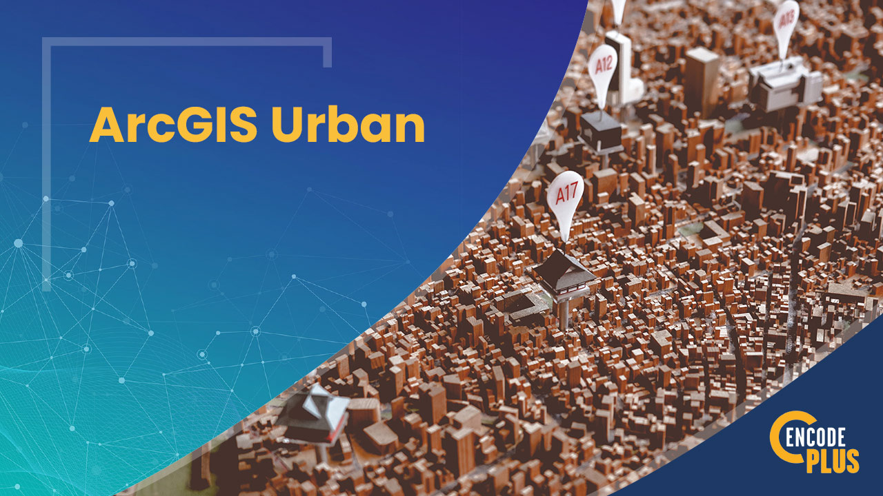
Planners have used site plan drawings and building elevations for decades to visualize proposed development. ArcGIS Urban is changing the way we plan.
Bring development scenarios to life with interactive 3D modeling.
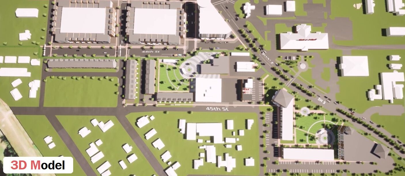
example: littleton, CO, TRANSIT-oRIENTED dEVELOPMENT (tod) sCENARIOS
What is 3d Scenario Modeling?
enCodePlus offers a revolutionary solution by combining scenario-planning elements from across the ESRI platform with its inherent 3D capabilities.
This powerful tool enables planners, decision-makers, and neighbors to effectively interact with the data and generate alternative building types, uses and forms.
The 3D capabilities allow for visualizing these alternatives in context and from different perspectives, and quantifying the resulting metrics such as number of residents, employees, square footage by building types, and parking requirements.
The Modeling process
A design charrette is held with elected officials and staff, property and business owners, and other stakeholders. The goal is to solicit input about future development preferences for the project area.
Alternative scenarios are evaluated, resulting in a conceptual development plan depicting realigned streets, assembled properties, new and repurposed building forms, and amenity spaces.
ArcGIS Urban extrudes the proposed new building footprints to the desired heights, allocates land uses, and produces preliminary metrics indicating unit counts, resident and employee populations, floor areas, etc.
A fly-through video can be produced to gain community support and to market the project to developers.
ArcGIS Urban was used to illustrate a proposed redevelopment scenario for this city center, which brought an enhanced sense of realism to charrette participants and city officials. The building types and forms were subsequently built in SketchUp and used to create a real-world fly-through video.
example: Dickinson, TX, envisioning change
How Can Advanced Visualization Up-Level Planning?
EXAMPLE: LITTLETON, CO
Visualization of “what-if” scenarios helps address challenges like:
Viewing proposed projects in real-world contexts
Better understanding the visual impacts and exploring potential design remedies
Seeing firsthand the effects on the surrounding development character and form
Engaging residents to gauge their sensitivities and build support for proposed projects
Evaluating alternatives
Testing the massing of buildings relative to sight lines and necessary transitions
Analyzing the resulting metrics generated by ArcGIS Urban
Evaluating the appropriateness and viability of proposed development or improvement projects
When to use ArcGIS Urban
Long-Range Planning: ArcGIS Urban is the perfect tool for evaluating future land use and 3D development scenarios to envision redevelopment and new growth areas.
Current Planning: Use of 3D visualization and contextual site analysis for proposed development applications aids site plan review and results in better projects.
Mitigation Measures: ArcGIS Urban makes it easy to evaluate proposed measures and mitigate potential impacts by producing on-the-fly building masses or rendering uploaded 3D models in a real-word context.
"If Only I Could Show the Proposed Project in 3D Context."
EVER HAD THIS THOUGHT?
How many times have good ideas or projects failed because decision-makers were unable to see your vision? Our custom GIS tools make it possible to visualize what can’t be described!
It’s difficult to picture what’s proposed using words and two-dimensional maps and drawings. With a real-world 3D model, maps and pictures are self-explanatory. Plus, an added benefit is the ability to quantify, compare and contrast the numbers to clearly illustrate the costs and benefits.
Why enCodePlus?
Our team of planning experts and former government staff has been in your shoes and we understand your challenges. We developed a municipal government software platform with powerful capabilities and the flexibility to customize features according to the unique needs of individual communities. We built enCodePlus for you!